UPDATE: A powerful winter storm has begun to hit New Jersey, bringing with it the potential for up to 9 inches of snow and significant travel disruptions. The storm, which started Friday afternoon, is expected to escalate overnight, with the heaviest snowfall occurring between 7 PM and 11 PM tonight.
The National Weather Service has issued winter storm warnings for 11 counties across northern New Jersey, where snowfall rates could reach 1 inch per hour. Additionally, winter weather advisories have been issued for an additional 8 counties due to a dangerous mix of snow, sleet, and freezing rain.
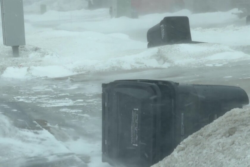
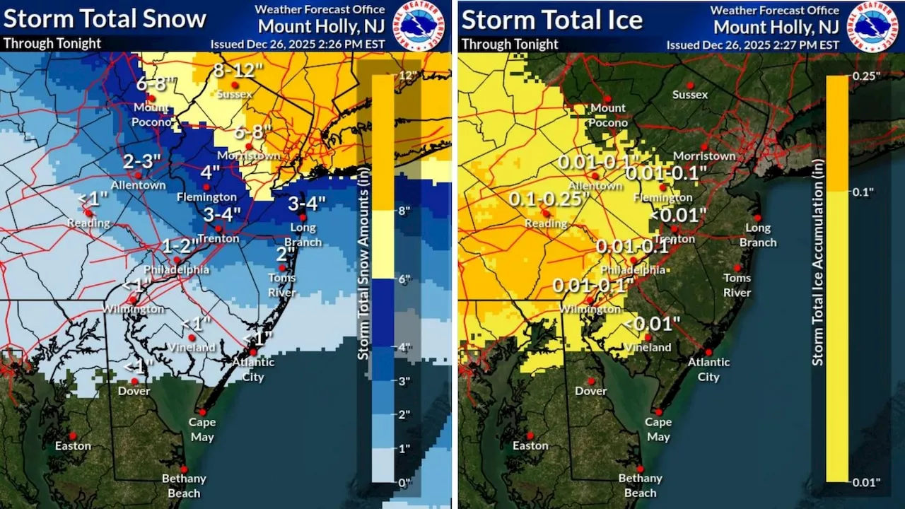
Travelers are urged to exercise caution, as conditions are expected to deteriorate rapidly. Visibility will be significantly reduced, and roads will become snow-covered, leading to potential delays and hazardous driving conditions. The forecast predicts widespread snowfall totals of 5 to 9 inches across northern New Jersey, with localized amounts possibly exceeding 10 inches in higher elevations.
The storm is set to continue through the night and into Saturday morning, with the heaviest precipitation tapering off by noon. Snow and sleet accumulations are expected to range from 4 to 7 inches in various regions, with light ice accumulations adding to the risk of treacherous conditions.
According to AccuWeather, areas with a fresh snowpack may remain below freezing throughout Saturday, complicating cleanup efforts. Light snow showers may linger into midday Saturday before improving conditions are predicted in the afternoon.
Looking ahead, Sunday will bring a welcome break from the storm, with high pressure moving through, but temperatures will remain low, with overnight lows expected in the teens inland and low 20s along the coast. Rain is forecast to develop Sunday evening, and while most areas will see above-freezing temperatures, some interior regions could briefly experience freezing rain.
Monday will usher in milder temperatures with highs reaching the upper 40s to lower 50s, but a strong cold front is anticipated to bring showers and gusty winds exceeding 40 mph later that day. Following the front, much colder air will settle in, with temperatures expected to remain in the lower to mid-30s throughout the week.
As this winter storm continues to develop, residents are encouraged to stay informed and prepared for rapidly changing weather conditions. The situation is evolving, and updates will be released as new information becomes available.
Stay safe and monitor local news sources for the latest developments.