UPDATE: A powerful winter storm is set to batter Cleveland and Northeast Ohio on December 25, 2023, bringing hazardous conditions including damaging winds up to 60 mph, rapidly falling temperatures, and snow squalls. This storm poses an immediate threat to travel and safety as conditions worsen throughout the day.
The storm’s cold front will sweep through late tonight into Monday morning, plummeting temperatures from the low 60s to the mid-20s within hours. Rain will transition to snow by mid-morning, creating treacherous road conditions. Snow squalls are expected to develop Monday afternoon and evening, with visibility dropping dramatically, making travel extremely risky.
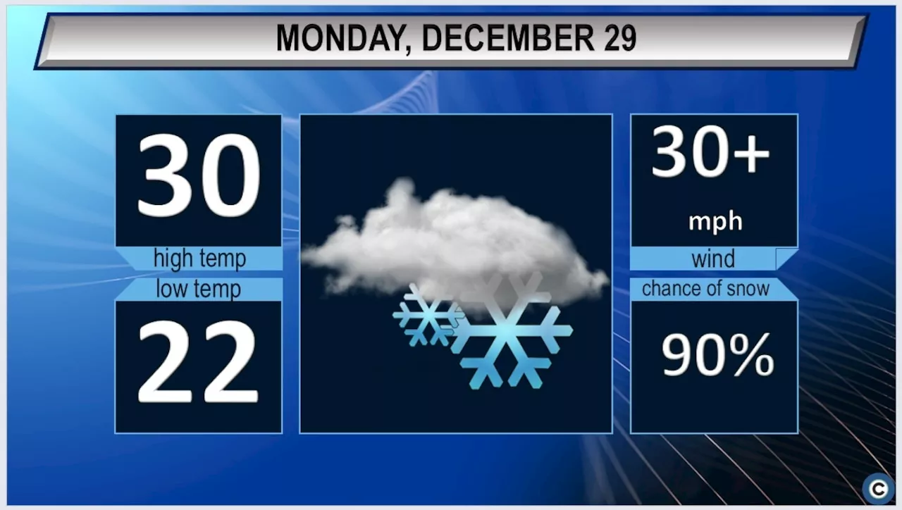
Forecasts predict snow accumulations between 3 and 7 inches, with higher totals in eastern Ashtabula and Geauga Counties. Wind gusts will reach 50 to 60 mph, exacerbating visibility issues due to blowing snow, especially during the evening commute when winds remain strong.
Authorities warn that wind chills could plunge into the low teens and single digits, creating dangerously cold conditions for residents. In anticipation of these extreme weather changes, officials are urging people to stay indoors and avoid unnecessary travel.
Lake-effect snow is likely to persist into Tuesday, particularly across the snowbelt regions of Northeast Ohio and Northwest Pennsylvania. Residents should prepare for additional snow later in the week as another weather system approaches the Great Lakes on Wednesday.
Looking ahead, cold conditions are anticipated for New Year’s Eve celebrations, with temperatures at or below freezing and wind chills possibly nearing zero by Friday morning.
Officials are closely monitoring the situation, emphasizing the importance of preparedness. Stay tuned for ongoing updates as this winter storm develops and impacts the region.
This urgent weather alert is crucial for anyone in the affected areas, so share this information to keep friends and family safe during these extreme conditions.