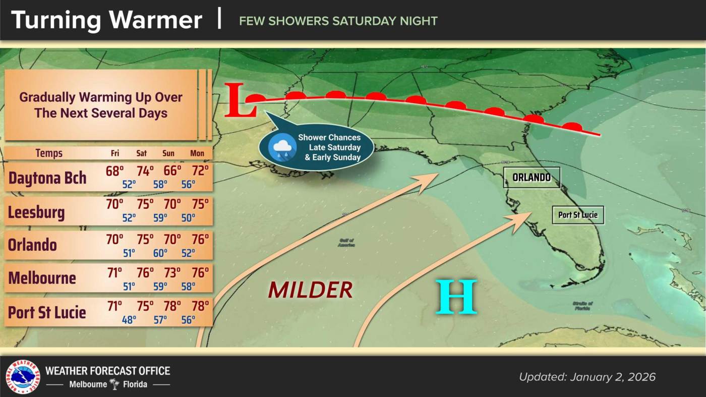
UPDATE: Central Florida is experiencing a significant warm-up today, with temperatures expected to reach around 70°F. As the region prepares for the weekend, a cold front is forecasted to bring a slight dip in temperatures and a chance for rain starting Saturday night.
The National Weather Service in Melbourne reports that Friday’s highs are set to climb to the low 70s, while overnight lows will rise to the upper 40s. This warming trend is anticipated to continue into Saturday before cooler air sweeps in from the Southeast U.S.
For now, residents can enjoy dry conditions across Central Florida as high pressure moves eastward. Light westerly winds are expected to prevail, creating pleasant weather for outdoor plans today. However, cloud cover is expected to increase by Friday night ahead of the incoming front.
The NWS notes, “Southwesterly flow increases locally ahead of the front, becoming up to 10-15 mph north of I-4 in the afternoon, with a few gusts near 20 mph.” While moisture levels will rise, the majority of Saturday is predicted to remain mostly dry, with scattered showers likely moving in after the cold front passes Saturday night.
Temperatures on Saturday will see a high of around the mid-70s, before cooler weather takes hold. Sunday is expected to bring highs in the 70s for most areas, although regions north of I-4 may experience a slight drop into the upper 60s. Overnight lows on Sunday are projected to be in the 50s.
Looking ahead to the beginning of next week, a warming trend will return, with temperatures climbing into the upper 70s to lower 80s by Thursday. Overnight temperatures will generally remain in the 50s, while coastal areas will see lows in the lower 60s.
Residents are encouraged to stay tuned for updates as conditions may change rapidly. This developing weather pattern could impact weekend plans, so those in Central Florida should prepare accordingly. Share this information to keep friends and family informed about the upcoming changes!