URGENT UPDATE: Alabama is bracing for a chilly start to the work week as temperatures plunge into the 30s and 40s tonight. The National Weather Service confirms that a significant cold front will grip the state, with chances of rain affecting mainly northeast Alabama today.
Residents should prepare for cooler temperatures across the state, with highs only reaching the 50s in northern and central regions. Rain is expected primarily in the northeast, while the bulk of Alabama remains dry.
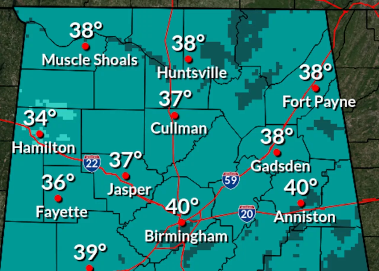
Forecasts show that overnight lows will drop to the 30s in northern Alabama and the low to mid-40s in the south, potentially leading to frost in many areas. The National Weather Service warns that frost may even linger in parts of south Alabama.
However, there is good news ahead! Starting Tuesday, temperatures are projected to rise significantly. By the end of the week, Alabama could experience highs in the 60s, 70s, and even 80s. The warm-up will begin with highs in the 70s statewide on Friday, signaling a welcome shift from the cold.
The latest forecasts indicate that Friday will bring highs ranging from the low 70s in the north to the upper 70s in the south, with some areas potentially reaching the 80s. The Climate Prediction Center also reports a 40-60% probability for above-average temperatures across Alabama from November 9-15, suggesting a pleasant stretch ahead.
As Alabama gears up for this weather transition, residents are encouraged to stay informed and adjust their plans accordingly. The impending warmth offers a stark contrast to the chilly start, making it a perfect time for outdoor activities later in the week.
Stay tuned for further updates as this weather pattern develops.