UPDATE: Residents of Staten Island should brace for rapidly deteriorating conditions tonight as dense fog and light rain are set to sweep across the area. The National Weather Service warns that visibility could drop to a quarter mile or less after sunset, making travel hazardous.
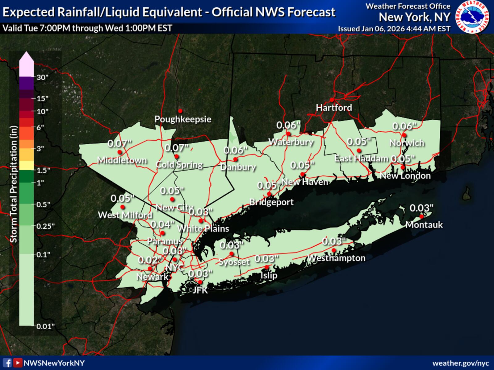
Starting this evening, temperatures in New York City are expected to remain above freezing, with lows ranging from the upper 30s to lower 40s. Light rain will begin shortly after sunset, with precipitation amounts staying under a tenth of an inch. This weather pattern is associated with a low-pressure system moving north of the region late tonight into early Wednesday.
Residents are urged to exercise caution, especially those traveling during the evening hours. The combination of rain and fog will create difficult driving conditions, increasing the risk of accidents.
In the early morning hours of January 4, Staten Island will experience a slight reprieve as conditions are expected to improve with gradual clearing. However, winds are forecasted to pick up, with gusts potentially reaching 25 mph. Daytime highs on Wednesday will rise to the mid to upper 40s, which is about 5 to 7 degrees above normal for this time of year.
As the week progresses, Thursday will continue the warming trend, with temperatures climbing into the 40s under high pressure. However, this will be short-lived, as a new frontal system is anticipated to move in, bringing clouds and a fresh round of rain from Friday through Saturday.
Looking ahead, weekend highs are expected to soar into the 50s, but colder air is forecasted to return by the end of the weekend. Residents are encouraged to stay informed and monitor local weather updates to prepare for the changing conditions.
This urgent weather alert serves as a reminder for Staten Island residents to take necessary precautions and stay safe during tonight’s forecasted conditions.